Seattle has a reputation as a car city. The hills are real. The rain is real. The parking is expensive and scarce. But the transit picture in 2026 looks different from what it did even three years ago, and for renters who want to ditch the car payment, the insurance, and the parking anxiety, the options are better than most people realize.
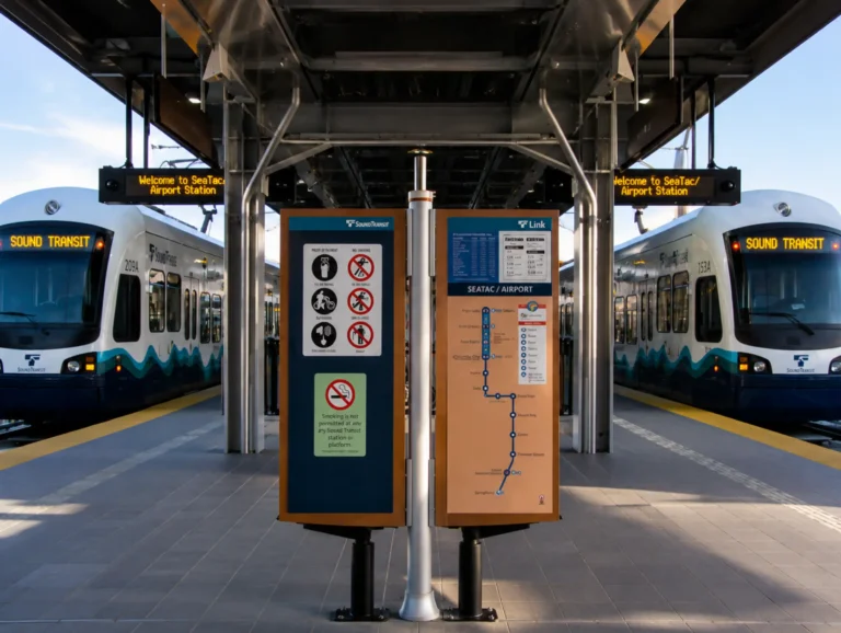
The Sound Transit Link Light Rail network now connects Redmond and Bellevue across Lake Washington, runs north through Northgate to Lynnwood, and extends south to Federal Way. The West Seattle Link Extension was approved by the Sound Transit Board in May 2026 and is moving toward a 2032 opening. The Ballard Link Extension Final EIS is expected in 2026 with a target opening around 2035 to 2037. Meanwhile, King County Metro’s RapidRide network fills in the gaps with high-frequency bus rapid transit across the city.
This guide covers the Seattle and Eastside neighborhoods where car-free living is genuinely practical in 2026, what transit lines serve each one, and what the rental market looks like for people who want to trade a parking spot for a transit pass.
How Seattle's Transit Network Works in 2026
Seattle’s transit system runs on several overlapping layers, and understanding which layer serves your neighborhood determines how car-free your life can actually be:
- Link Light Rail (1 Line and 2 Line): The fastest, most reliable transit in the region. Runs every 8 to 15 minutes during peak hours. The 1 Line runs from Lynnwood through downtown Seattle to Federal Way. The 2 Line now connects Redmond Technology Center through downtown Bellevue, Mercer Island, and into downtown Seattle, opening up the Eastside to car-free living in a way that was not possible before 2025
- RapidRide Bus Rapid Transit: High-frequency bus lines that run every 10 to 15 minutes during peak hours with dedicated bus lanes on key corridors. Lines A through H serve major Seattle neighborhoods and connect to light rail. If you are between light rail stations, RapidRide is what makes the connection work
- King County Metro buses: The backbone of Seattle transit, with over 150 routes. Frequency varies widely by route. Routes 40, 44, and 62 are among the most useful for connecting neighborhoods that do not have light rail or RapidRide
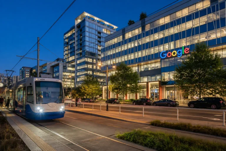
- Seattle Streetcar: Two lines. The First Hill Streetcar connects Capitol Hill to the International District. The South Lake Union Streetcar (the “SLUT” to locals) connects Westlake to South Lake Union. Useful for short trips within their corridors
- Water Taxi and Ferry: West Seattle has a water taxi to downtown. Bainbridge Island and Bremerton are accessible by Washington State Ferry from downtown Seattle. For renters commuting from West Seattle or considering island living, these are viable daily commuter options
The ORCA card is the single payment system that works across all of these networks. One tap covers light rail, bus, streetcar, water taxi, and even the Sounder commuter rail. If you are committing to car-free living in Seattle, the ORCA card is non-negotiable.
Looking for a rental in a Seattle transit corridor?
SJA manages rental properties across Seattle and the Eastside, including neighborhoods along the Link Light Rail and RapidRide networks. A free rental estimate tells you what current market rents look like for the specific area you are targeting.
Get your free Seattle rental estimate from SJA Property Management
The Best Seattle Neighborhoods for Car-Free Living in 2026
Capitol Hill
- Walk Score: 96
- Transit access: Excellent. The Capitol Hill Station on the Link Light Rail 1 Line puts you 6 minutes from downtown Seattle by train. Multiple bus routes including the 10, 11, 43, and 49 run frequently. The First Hill Streetcar connects to the International District and First Hill.
- The vibe: Seattle’s most vibrant neighborhood for car-free living. Dense with restaurants, bars, coffee shops, boutiques, and music venues within walking distance. Flat enough at the center that daily errands on foot are genuinely easy. Evening and weekend transit keeps running late enough for a real social life without a car.
- Key lines: Link Light Rail 1 Line (Capitol Hill Station), Routes 10, 11, 43, 49, First Hill Streetcar
Capitol Hill is among SJA’s most requested Seattle neighborhoods for renters relocating from tech-company campuses. Easy light rail access to Amazon’s downtown offices and a 25-minute rail connection to Bellevue make it a strong choice for Eastside employees who prefer urban Seattle living.
Downtown, Belltown, and South Lake Union
- Walk Score: 99 / 98 / 95
- Transit access: Transit Score 100 in downtown and Pioneer Square. Multiple light rail stations. Over 50 bus lines. The South Lake Union Streetcar. Direct access to every major transit corridor in the region.
- The vibe: The maximum transit density in Seattle. If you work downtown or in South Lake Union, you may never need public transit at all. Your office, grocery store, gym, and restaurant could all be within a 10-minute walk. Belltown is flat and extremely walkable. South Lake Union skews tech and condo-heavy with Amazon campus workers as the dominant tenant demographic.
- Key lines: Link Light Rail 1 Line (Westlake, University, Pioneer Square, International District stations), South Lake Union Streetcar, RapidRide C, D, E lines, dozens of Metro routes
Median rents in South Lake Union and Belltown run $2,200 to $3,000+ for 1-bedrooms reflecting the premium location. For Amazon employees specifically, South Lake Union provides a zero-commute option. For non-SLU workers, the transit access to every other part of the city is genuinely unmatched.
University District
- Walk Score: 94
- Transit access: The U District Station on the Link Light Rail 1 Line opened in 2021 and transformed this neighborhood. A 7-minute train to downtown. Frequent buses including the 44, 48, and 70. The Burke-Gilman Trail connects cyclists to Fremont, Ballard, and the Eastside without touching a road.
- The vibe: College-neighborhood energy with genuinely excellent transit. Walkable main streets along The Ave and University Way. Dense with cheap eats, coffee, bookstores, and parks. Increasingly popular with young professionals who want lower rents than Capitol Hill with better transit than Ballard.
- Key lines: Link Light Rail 1 Line (U District Station), Routes 44, 48, 70, Burke-Gilman Trail for cycling
The U District has one of the strongest value-to-transit ratios in Seattle. 1-bedroom rents average $1,900 to $2,400 depending on building age and amenities, making it significantly more affordable than Capitol Hill or South Lake Union with equivalent or better light rail access.
Beacon Hill, Columbia City, and Rainier Valley
- Walk Score: 88 / 84 / 82
- Transit access: All three neighborhoods sit directly on the Link Light Rail 1 Line. Beacon Hill Station puts you 10 minutes from downtown. Columbia City Station is walkable to the main commercial strip on Rainier Avenue. Othello and Rainier Beach stations extend the corridor further south.
- The vibe: Beacon Hill has become one of Seattle’s most talked-about neighborhoods for transit-oriented living. The main commercial strip along Beacon Avenue is walkable and increasingly diverse with restaurants, coffee shops, and small grocers. Columbia City has a charming, small-town-feeling commercial district that punches well above its size. Both are significantly more affordable than north Seattle neighborhoods with equivalent or better light rail access.
- Key lines: Link Light Rail 1 Line (Beacon Hill, Columbia City, Othello, Rainier Beach stations), Routes 36, 106
Northgate
- Walk Score: 82
- Transit access: The Northgate Station on the Link Light Rail 1 Line opened in 2021. Direct light rail to downtown Seattle in about 14 minutes. Connects northward to Roosevelt, U District, and Capitol Hill without transfers. The Northgate Transit Center is one of the region’s busiest bus hubs with direct routes across North Seattle and to the Eastside.
- The vibe: Northgate is a neighborhood in transition. The light rail arrival has accelerated development around the station area, and new mixed-use buildings continue to add density. The Northgate Mall has been reimagined as a retail and entertainment complex. Less urban character than Capitol Hill or the U District, but strong transit and improving walkability around the station.
- Key lines: Link Light Rail 1 Line (Northgate Station), RapidRide E Line, multiple North Seattle Metro routes
Ballard
- Walk Score: 89
- Transit access: Currently served primarily by the RapidRide D Line, which runs from Ballard to downtown Seattle via Interbay in about 30 minutes. Route 44 connects east toward the U District. The Ballard Link Extension is in environmental review with a Final EIS expected in 2026 and light rail service targeted for 2035 to 2037. Car-free living is viable but requires more planning than light rail neighborhoods.
- The vibe: One of Seattle’s most beloved neighborhoods with a walkable commercial district along Market Street, NW 65th, and the waterfront. Excellent restaurants, bars, a farmers market, and the Hiram Chittenden Locks within walking distance. The bike network including the Burke-Gilman Trail extension makes cycling to the U District viable for many residents.
- Key lines: RapidRide D Line (downtown), Route 44 (U District), Route 40 (Fremont, SLU), Burke-Gilman Trail (cycling)
Fremont
- Walk Score: 92
- Transit access: No light rail currently. Served by Route 40 (connects to SLU and downtown via Westlake), Route 62 (connects to Green Lake and U District), and the Burke-Gilman Trail for cyclists. Car-free living requires active reliance on buses and biking. Downtown is 20 to 30 minutes by bus.
- The vibe: Fremont is the neighborhood that makes car-free skeptics reconsider. Called the “Center of the Universe” by its residents, it has some of the best restaurants in the entire city, a walkable main street, the Sunday Farmers Market, the Fremont Troll, and strong community character. The flat terrain along the ship canal makes cycling practical. For renters who work in Fremont itself or in SLU, the bus network is sufficient. For those commuting to other parts of the city, it requires planning.
- Key lines: Route 40 (SLU, Westlake, Ballard), Route 62 (Green Lake, U District), Burke-Gilman Trail
Fremont consistently ranks as one of Seattle’s most desirable rental neighborhoods. 1-bedroom rents average $1,900 to $2,400 depending on building age. Landlords with Fremont properties should note that Route 40 is one of King County Metro’s most frequently used routes, and renters who cycle find Fremont extremely accessible to a wide range of employment centers.
West Seattle
- Walk Score: 77
- Transit access: The RapidRide C Line connects West Seattle Junction to downtown in about 30 minutes. The West Seattle Water Taxi provides a scenic alternative commute to downtown during operating hours. The West Seattle Link Extension was approved in May 2026 with light rail service planned for approximately 2032 at three stations: SODO, Delridge, and Alaska Junction.
- The vibe: West Seattle feels more like a self-contained town than a Seattle neighborhood. The Junction commercial district along California Avenue has everything from grocery stores to independent restaurants to a movie theater within walking distance. The community identity is strong. Car-free living is viable today for those who work downtown or can work remotely, and becomes significantly easier once light rail arrives in 2032.
- Key lines: RapidRide C Line (downtown, SODO), West Seattle Water Taxi (downtown, seasonal), Routes 21, 55, 56. Light rail coming 2032.
The Eastside: Car-Free Living Just Became Possible
The most significant transit development for Seattle-area renters in 2025 was the full opening of the East Link Extension (Line 2), connecting Redmond Technology Center through downtown Bellevue, Mercer Island, and into downtown Seattle. This changed the transit calculation for the entire Eastside.
Downtown Bellevue
- Walk Score: 73 (transitioning rapidly)
- Transit access: The Link Light Rail 2 Line now connects downtown Bellevue to downtown Seattle in approximately 25 minutes with no transfers. The Bellevue Transit Center serves as a major hub for East King County bus routes. Car-free living in downtown Bellevue is increasingly viable for tech workers whose offices are within the Bellevue urban core.
- The vibe: Downtown Bellevue has evolved significantly over the past five years. The combination of Amazon’s Bellevue offices, Microsoft’s campus in Redmond (three stops away by light rail), and the upcoming Nobu restaurant at Avenue Bellevue signals a city rapidly developing the urban character to support car-free living. The pedestrian network around the Lincoln Square corridor is already strong.
- Key lines: Link Light Rail 2 Line (Downtown Bellevue Station, Bellevue Spring District Station), multiple East King County Metro routes
For our full analysis of how the tech sector and light rail are reshaping Eastside rental demand, see our Eastside Seattle rentals and tech sector guide.
Redmond
- Walk Score: 59 (near transit center)
- Transit access: The Link Light Rail 2 Line terminates at Redmond Technology Center, directly adjacent to Microsoft’s main campus. A second station at Downtown Redmond serves the city’s growing retail and restaurant district. Light rail to downtown Seattle takes approximately 45 to 50 minutes with no transfers.
- The vibe: Redmond’s car-free case is specific: if you work at Microsoft or for a Microsoft vendor, light rail puts you on campus without a car or a parking permit. For residents whose daily life centers on the Redmond Town Center and Microsoft campus area, the walkability and transit picture is more compelling than Redmond’s overall walk score suggests.
- Key lines: Link Light Rail 2 Line (Redmond Technology Center, Downtown Redmond stations), multiple East King County Metro routes
What to Look for in a Transit-Oriented Rental
If transit access is a priority in your rental search, here is what to evaluate beyond the neighborhood:
- Walk time to the nearest station or stop: Under 10 minutes to a light rail station or RapidRide stop is the threshold for genuinely car-free living. At 15 to 20 minutes, you are looking at a 30 to 40 minute roundtrip walk just to reach the transit network, which makes biking or occasional rideshares a practical necessity
- Frequency of service at your actual hours: A bus line that runs every 30 minutes during peak hours but every hour after 9 PM is not reliable for night-shift workers, people with irregular schedules, or anyone who wants to stay out past midnight on a weekend. Check the schedule for your actual usage pattern
- Last-mile connections: Light rail gets you close. Walking or cycling gets you there. Check whether the final stretch from the station to your workplace, grocery store, and social destinations is walkable or requires a second transit transfer
- Grocery and daily errands on foot: According to Walk Score data for Seattle, a Walk Score above 90 indicates that daily errands can be accomplished on foot. This number matters more than neighborhood prestige for practical car-free living
- Secure bike storage in the building: For the last-mile problem, a good bike is often the answer. A building with secure, covered bike storage makes cycling a viable daily option. A building where you have to carry your bike up three flights of stairs makes it a weekend-only activity
What Is Coming Next: The 2026 to 2037 Transit Horizon
According to NextStop’s 2026 Seattle Link Light Rail expansion map, the transit improvements coming in the next decade will significantly expand the neighborhoods where car-free living is practical:
- NE 130th Street Infill Station (targeted 2025 to 2026): A new light rail station between Northgate and Shoreline that will bring light rail access to Lake City and Haller Lake for the first time. Long-underserved neighborhoods north of Northgate become transit-accessible
- Graham Street Infill Station (TBD, funded): A new station on the 1 Line between Columbia City and Othello that will benefit the Rainier Valley corridor. Funding is secured but the timeline is still being confirmed
- West Seattle Link Extension (targeted 2032): SODO, Delridge, and Alaska Junction stations. The Sound Transit Board voted to advance this project in May 2026 with cost-saving design refinements
- Ballard Link Extension (targeted 2035 to 2037): Will finally bring light rail to Ballard and create a new downtown transit tunnel. This is the single most anticipated transit project in Seattle’s history for north-end renters and homeowners
- Everett Link Extension (construction 2030 to 2036, opening 2037 to 2041): Extends the 1 Line north all the way to Everett, opening up Shoreline, Mountlake Terrace, Lynnwood, Mukilteo, and Everett to light rail commuting to Seattle
What This Means for Seattle Rental Properties
For property owners, transit access is increasingly a primary driver of rental demand and rent premiums. Properties within a 10-minute walk of a light rail station consistently lease faster, attract a broader applicant pool including car-free renters, and command measurably higher rents than comparable properties without station proximity.
The East Link Extension’s opening in 2025 expanded transit-premium rental demand from Seattle’s urban core to Bellevue, Redmond, and the Eastside corridor for the first time. The 2032 West Seattle extension and 2035 to 2037 Ballard extension will do the same for those neighborhoods when they arrive.
For landlords managing properties in transit-accessible neighborhoods, marketing to car-free renters is a specific and productive tenant acquisition strategy. This means advertising proximity to specific stations by walk time rather than just neighborhood name, highlighting bike storage and transit pass options in listings, and pricing with awareness of the transit premium that light rail access commands.
SJA manages rental properties across Seattle and the Eastside, including properties along the Link Light Rail corridors in Capitol Hill, Beacon Hill, Columbia City, Northgate, and the new East Link markets in Bellevue and Redmond. For a current market analysis of what your transit-accessible property is worth, start with a free rental estimate.
Own a rental property near a Seattle or Eastside transit line?
Transit access drives rental demand and premium pricing. SJA can give you a current market estimate for your specific property and neighborhood, including how proximity to light rail or RapidRide affects your achievable rent.
All transit information is current as of June 2026. Sound Transit project timelines are subject to change. Walk Scores sourced from Walk Score 2025 to 2026 data. For the most current transit schedules and station information, visit soundtransit.org.